Is the South Sandwich Islands region experiencing frequent strong earthquakes?

  • Thread starter davenn
  • Start date
In summary, there was a Mw7.5 earthquake in the South Sandwich Islands region on August 12, 2021, followed by a M8.1 earthquake just under 3 minutes later. The USGS has determined that the M8.1 earthquake was actually a mainshock to the M7.5 foreshock. This explains the very active aftershock sequence and the initial confusion about the number of earthquakes. The distance between the two earthquakes was about 100-120 km. The Sandwich Islands are located about 8500 miles from the South Sandwich Islands, and were named after a patron of Captain James Cook.
  • #1
davenn
Science Advisor
Gold Member
2023 Award
9,598
10,303
another day, another big quake

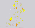
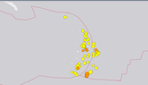
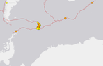
Mw7.5 South Sandwich Isl, South Atlantic

M 7.5 - South Sandwich Islands region​

  • 2021-08-12 18:32:54 (UTC)
  • 57.596°S 25.187°W
  • 63.3 km depth
210812  UT Mw7.5 South Sandwich Isl.gif
 
  • Wow
Likes Astronuc
Earth sciences news on Phys.org
  • #2
You need to turn off your seismo Dave! That's the only way to stop all of these earthquakes!
 
  • Haha
Likes sysprog, davenn, anorlunda and 2 others
  • #3
There's a lot of seismic activity in the region. About 30 aftershocks from 4.8 to 6.2 Mag, and one 4.9 mag earthquake near the South Georgia Island.

https://en.wikipedia.org/wiki/South_Georgia_and_the_South_Sandwich_Islands
https://earthquake.usgs.gov/earthquakes/eventpage/us6000f4ly/executive

From USGS us6000f4ly/executive:
Over the previous century, seven other M7+ earthquakes occurred within 250 km of the August 2021 earthquake. The largest of these earthquakes was an M7.8 in May 1964. M7+ earthquakes in the South Sandwich Island region historically have occur at intermediate-depths (broadly defined as 70-300 km depth). The largest earthquake in the region was an M8.1 earthquake on June 27, 1929 and was located ~360 km northwest of the of August 2021 earthquake along the northern boundary of the Scotia plate with the South America plate. None of these earthquakes are known to have caused fatalities, likely because of their remote location far from population centers that might be vulnerable to earthquake shaking, as well as their intermediate depths which are not normally conducive to the generation of tsunamis.
 

Attachments

  • South_Georgia,South_Sandwich_Islands_2021-08-12_Earthquakes.png
    South_Georgia,South_Sandwich_Islands_2021-08-12_Earthquakes.png
    79.9 KB · Views: 153
  • Like
Likes davenn and dlgoff
  • #4
I had no idea how far the Sandwich Islands are from the South Sandwich Islands. (My geography stinks) 8500 miles.
 
  • Like
Likes davenn
  • #5

M 6.3 - South Sandwich Islands region​

https://earthquake.usgs.gov/earthquakes/eventpage/us6000f5h2/executive
  • 2021-08-13 10:34:29 (UTC)
  • 60.491°S 27.177°W
  • 10.0 km depth
This one is relatively shallow, and it's near the intersection of the Antarctic, Scotia (and Sandwich) and South American plates.
https://en.wikipedia.org/wiki/Scotia_Plate
https://en.wikipedia.org/wiki/Antarctic_Plate
https://en.wikipedia.org/wiki/South_American_Plate

Another 30 aftershocks including the 6.3 Mag since my previous post.

All aftershocks between 7.5 and 6.3 Mag in format: Mag, Date/Time, Depth

5.1 2021-08-13 03:11:18 (UTC-07:00) 10.0 km
5.0 2021-08-13 02:01:24 (UTC-07:00) 35.0 km
5.1 2021-08-13 01:46:29 (UTC-07:00) 53.5 km
5.2 2021-08-13 01:33:13 (UTC-07:00) 10.0 km
5.0 2021-08-13 01:25:00 (UTC-07:00) 54.8 km
5.0 2021-08-13 00:13:56 (UTC-07:00) 37.1 km
5.2 2021-08-13 00:08:37 (UTC-07:00) 10.0 km
5.2 2021-08-13 00:04:34 (UTC-07:00) 10.0 km
5.0 2021-08-12 23:41:46 (UTC-07:00) 66.8 km
5.0 2021-08-12 23:34:34 (UTC-07:00) 10.0 km
5.5 2021-08-12 23:14:11 (UTC-07:00) 10.0 km
5.1 2021-08-12 22:44:04 (UTC-07:00) 45.3 km
5.0 2021-08-12 22:41:24 (UTC-07:00) 45.8 km
5.5 2021-08-12 22:24:58 (UTC-07:00) 31.6 km
5.3 2021-08-12 22:24:04 (UTC-07:00) 58.7 km
5.3 2021-08-12 21:53:09 (UTC-07:00) 10.0 km
5.1 2021-08-12 21:03:58 (UTC-07:00) 10.0 km
5.1 2021-08-12 20:53:21 (UTC-07:00) 35.0 km
5.7 2021-08-12 20:43:19 (UTC-07:00) 66.2 km
5.1 2021-08-12 20:38:23 (UTC-07:00) 10.0 km
4.6 2021-08-12 19:57:27 (UTC-07:00) 10.0 km
5.2 2021-08-12 19:33:40 (UTC-07:00) 10.0 km
4.9 2021-08-12 19:29:33 (UTC-07:00) 25.4 km
5.3 2021-08-12 18:47:37 (UTC-07:00) 10.0 km
4.9 2021-08-12 18:39:15 (UTC-07:00) 46.1 km
5.0 2021-08-12 18:26:41 (UTC-07:00) 31.1 km
4.6 2021-08-12 18:08:59 (UTC-07:00) 10.0 km
5.1 2021-08-12 17:46:19 (UTC-07:00) 10.0 km
5.0 2021-08-12 17:42:25 (UTC-07:00) 10.0 km
5.1 2021-08-12 17:04:15 (UTC-07:00) 10.0 km
5.4 2021-08-12 16:50:11 (UTC-07:00) 10.0 km
5.0 2021-08-12 16:32:56 (UTC-07:00) 19.9 km
5.4 2021-08-12 16:24:27 (UTC-07:00) 51.0 km
5.2 2021-08-12 16:23:45 (UTC-07:00) 52.9 km
4.9 2021-08-12 16:20:03 (UTC-07:00) 35.0 km
5.0 2021-08-12 16:08:13 (UTC-07:00) 35.0 km
4.8 2021-08-12 16:07:41 (UTC-07:00) 35.0 km
4.9 2021-08-12 15:40:01 (UTC-07:00) 35.0 km
4.9 2021-08-12 15:19:11 (UTC-07:00) 35.0 km
5.1 2021-08-12 15:13:10 (UTC-07:00) 35.0 km
5.5 2021-08-12 15:08:35 (UTC-07:00) 35.0 km
5.1 2021-08-12 14:56:55 (UTC-07:00) 10.0 km
5.1 2021-08-12 14:48:23 (UTC-07:00) 60.7 km
4.9 2021-08-12 14:25:14 (UTC-07:00) 35.0 km
5.2 2021-08-12 14:19:55 (UTC-07:00) 35.0 km
5.6 2021-08-12 14:07:01 (UTC-07:00) 69.3 km
5.2 2021-08-12 13:49:54 (UTC-07:00) 51.9 km
5.4 2021-08-12 13:38:07 (UTC-07:00) 69.6 km
5.3 2021-08-12 13:36:23 (UTC-07:00) 65.2 km
5.0 2021-08-12 13:28:40 (UTC-07:00) 60.1 km
5.4 2021-08-12 13:15:17 (UTC-07:00) 35.0 km
5.0 2021-08-12 13:14:45 (UTC-07:00) 35.0 km
5.8 2021-08-12 13:06:37 (UTC-07:00) 76.4 km
4.9 2021-08-12 13:05:00 (UTC-07:00) 10.0 km
5.5 2021-08-12 12:58:58 (UTC-07:00) 10.0 km
6.2 2021-08-12 12:44:55 (UTC-07:00) 61.9 km
6.0 2021-08-12 12:43:49 (UTC-07:00) 67.7 km
5.1 2021-08-12 12:39:22 (UTC-07:00) 10.0 km
5.7 2021-08-12 12:29:14 (UTC-07:00) 48.0 km
5.9 2021-08-12 12:07:52 (UTC-07:00) 18.9 km
5.9 2021-08-12 11:49:54 (UTC-07:00) 47.3 km

And this just in

M 5.8 - South Sandwich Islands region​

https://earthquake.usgs.gov/earthquakes/eventpage/us6000f5i9/executive
  • 2021-08-13 11:45:39 (UTC)
  • 57.285°S 25.558°W
  • 43.8 km depth
 
  • #6
Well, very interesting developments for this sequence
The USGS have determined there were 2 separate quakes just under 3 minutes apart ...

M 8.1 - South Sandwich Islands region​

  • 2021-08-12 18:35:20 (UTC)
  • 58.416°S 25.321°W
  • 48.3 km depth
Seismic observations suggest this earthquake is part of a complex seismic sequence. Our current interpretation is that this earthquake is the mainshock to a M7.5 that occurred ~170s earlier. The location, depth, mechanism, and magnitude of this earthquake is preliminary and less well constrained than typical events of this size due to interference from the preceding M7.5 foreshock. Research is being conducted on this sequence to better understand the faulting geometry and details of rupture. This analysis will take time and our understanding will likely evolve. This page will be updated as we learn more about these interesting events.
https://earthquake.usgs.gov/earthquakes/eventpage/us6000f53e/executive

This does help to explain the VERY active aftershock sequence. And it also explains why I got around 30 mins or so of
wall to wall signal from what was initially listed as a single Mw7.5 event.
 
  • Wow
  • Informative
Likes Astronuc and Bystander
  • #7
Comparing the 7.5 location and depth: 57.596°S 25.187°W, 63.3 km depth
with the Mag 8.1 location and depth: 58.416°S 25.321°W, 48.3 km depth

Distance
56.963 statute mi​
49.499 naut mi​
91.673 km​
ellipsoidal earth
Distance calculator: https://stevemorse.org/nearest/distance.php

The latter quake was not quite on top of the other, and it was shallower.
 
  • Like
Likes davenn
  • #8
Astronuc said:
The latter quake was not quite on top of the other, and it was shallower.

Yes, about 100 - 120 km south of the M7.5
 
  • #9
Vanadium 50 said:
I had no idea how far the Sandwich Islands are from the South Sandwich Islands. (My geography stinks) 8500 miles.
In my opinion, that's more history than geography -- Sandwich was a patron of Captain Cook, who named an achipelago of islands that he had discovered after him -- they later became called the Hawaiian Islands -- the Brits also named the (now uninhabited) South Sandwich Islands after him -- I think that neither set of islands, nor the familiar food assemblage, should ever have been named after him.
 
  • Like
  • Informative
Likes BillTre, Astronuc and davenn
  • #11
  • #12
Astronuc said:
M 6.9 - 136 km SE of Perryville, Alaska

Yes, recorded that one reasonably well

210814  UT Mw6.9 Alaskan ashk1.gif


but it hadnt event tailed off properly when the 7.2 hit and then the 7.2 totally overrode the 6.9 in amplitude ...

210814  UT Mw6.9 Alaskan ashk 7.2 Haiti.gif
Dave
 
  • #13
  • Like
Likes davenn
  • #14
Astronuc said:
Still strong activity in the area

yup and a 6.9 on the 16th ... recorded that one quite well
 
  • #16
As of Friday, ongoing aftershocks in the 4.7-5.2 Mag range

5.2 2021-08-20 08:56:51 (UTC-07:00) 12.7 km
5.1 2021-08-20 08:07:47 (UTC-07:00) 56.8 km
4.8 2021-08-20 04:16:16 (UTC-07:00) 21.7 km
5.2 2021-08-19 20:41:22 (UTC-07:00) 80.9 km
5.1 2021-08-19 20:21:33 (UTC-07:00) 35.0 km
5.1 2021-08-19 20:13:51 (UTC-07:00) 10.0 km
4.7 2021-08-19 19:42:30 (UTC-07:00) 28.6 km
5.0 2021-08-19 18:09:51 (UTC-07:00) 10.0 km
5.1 2021-08-19 14:26:32 (UTC-07:00) 10.0 km

And the magnitudes don't appear to be diminishing in intensity after one week, although they seem to diminish in frequency.
 
  • #18
Another couple of large aftershocks from the South Sandwich Islands

M 6.8 - South Sandwich Islands region​

  • 2021-08-22 00:45:08 (UTC)
  • 60.122°S 24.344°W
  • 11.0 km depth

M 7.1 - South Sandwich Islands region​

  • 2021-08-22 21:33:20 (UTC)
  • 60.291°S 24.895°W
  • 14.0 km depth

Mw6.8 and Mw7.1

2108122  UT M6.8 and 7.1 ashks South Sandwich Isl2.gif
 
  • #19
davenn said:
Another couple of large aftershocks from the South Sandwich Islands
I was wondering if we might see another in the 7 Mag range, and 6.8 was close.

I was looking at events in the region. I grabbed a couple of screenshots of the earthquakes over 7 days ending yesterday. The 7.1 and 6.8 are at the lower right of the group, near the triple intersection.
 

Attachments

  • SouthSandwichIslands_2021-08-23 Latest Earthquakes(last7days).png
    SouthSandwichIslands_2021-08-23 Latest Earthquakes(last7days).png
    12.8 KB · Views: 119
  • SouthSandwichIslands_Region_2021-08-23 Earthquakes(last7days).png
    SouthSandwichIslands_Region_2021-08-23 Earthquakes(last7days).png
    9.4 KB · Views: 124
Last edited:
  • Like
Likes davenn
  • #20
Still activity in the South Sandwich Islands, and some isolated tremors along the Antarctic Plate boundary
Code:
5.0  South Sandwich Islands region  2021-08-29 07:53:24 (UTC-07:00)  48.3 km
4.7  Southwest Indian Ridge         2021-08-29 07:13:12 (UTC-07:00)  10.0 km
4.9  South Sandwich Islands region  2021-08-29 06:04:04 (UTC-07:00)  41.4 km
5.3  southwest of Africa            2021-08-28 21:01:18 (UTC-07:00)  10.0 km
4.9  South Shetland Islands         2021-08-28 16:08:55 (UTC-07:00)  14.9 km
5.1  South Sandwich Islands region  2021-08-28 13:10:11 (UTC-07:00)  50.6 km
 

Attachments

  • Earthquakes_08302021_South Sandwich Islands and Antarctic Plate(last7days).png
    Earthquakes_08302021_South Sandwich Islands and Antarctic Plate(last7days).png
    15.2 KB · Views: 112
  • Like
Likes davenn

Related to Is the South Sandwich Islands region experiencing frequent strong earthquakes?

1. What is the current earthquake activity in the South Sandwich Islands region?

The South Sandwich Islands region is currently experiencing frequent strong earthquakes. According to the United States Geological Survey (USGS), there have been over 50 earthquakes with a magnitude of 4.5 or higher in the past year alone.

2. What is causing these frequent strong earthquakes in the South Sandwich Islands region?

The South Sandwich Islands are located on the boundary of the South American and Scotia tectonic plates, which are constantly moving and shifting. This movement can cause stress and tension to build up in the Earth's crust, leading to frequent earthquakes.

3. Are these frequent strong earthquakes in the South Sandwich Islands region dangerous?

While the South Sandwich Islands region experiences frequent strong earthquakes, the majority of them occur in remote areas and do not pose a significant threat to human populations. However, these earthquakes can still cause damage to infrastructure and buildings in the region.

4. Is there a pattern to the frequency of strong earthquakes in the South Sandwich Islands region?

There is no clear pattern to the frequency of strong earthquakes in the South Sandwich Islands region. Earthquakes can occur at any time and their frequency can vary greatly. However, scientists continue to monitor the region for any potential patterns or trends.

5. Can we predict when the next strong earthquake will occur in the South Sandwich Islands region?

Unfortunately, it is not currently possible to predict exactly when and where an earthquake will occur. While scientists can monitor and track seismic activity in the South Sandwich Islands region, there is still much to be learned about the Earth's complex systems and how they contribute to earthquakes.

Similar threads

Replies
2
Views
1K
Replies
8
Views
1K
  • Earth Sciences
Replies
1
Views
1K
Replies
2
Views
1K
  • Earth Sciences
Replies
5
Views
1K
Replies
2
Views
1K
  • Earth Sciences
Replies
2
Views
1K
Replies
1
Views
760
Replies
4
Views
1K
Replies
5
Views
1K
Back
Top